Categories
- Agriculture / Farm
- Animals
- Arts / Crafts
- Beauty / Fashion
- Books / Literature
- Business / Finance
- Cities / Places
- Computers / IT
- Construction
- Materials & Supplies
- Ecology / Climate
- Educational
- Electronics
- Energy / Utilities
- Food / Drinks
- Games
- General
- Geography
- Geology
- Health / Fitness
- History
- Home / Garden
- Jobs / Careers
- Kids / School
- Law / Government
- Music / Movies / TV
- News / Media
- Occasions
- Christmas
- Easter
- Halloween
- New Year
- Saint Patrick's Day
- Thanksgiving
- Valentine's Day
- Outdoors
- Religion / Belief
- Safety / Prevention
- Science
- Astronomy
- Biology
- Chemistry
- Physics
- Seasonal
- Shopping
- Society / Culture
- Sports
- Tools / Equipment
- Travel / Tourism
- Vehicles
Geography Crossword Puzzles
Free printable geography crossword puzzles. Download pre-made or create your own Crossword using our crossword maker. Simply download, print and start playing or play online.
point on the earth´s surface above the focus of an earthquake, type of graph that shows how quickly a river responds to a rainfall event, a tidal …
desert climates occur in places where air is.., a plant with spikes for leaves and which stores water in its stems, these stand above the ground to …
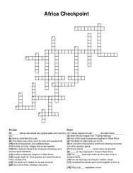
_ is very important in ancient west africa, the _ trade was made up of the two most in demand items, the act of giving one thing for another; taxed, …
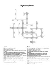
if a body of water has no means of getting rid of water except evaporation, does it contain salt or fresh water?, the process by which a gas turns …
this means half of the globe or earth, this is another term for the lines the run from the north pole to the south pole, a sphere shaped model of the …
phosphorus on earth is tied up in rock and sedimentary deposits, from which it is released by _ , the rigid outer part of the earth, consisting of the …
the part of the river near the sea, which is affected the rise and fall of the tide, steep, fast flowing section of a river with steep-sided, v-shaped …
steep areas of land with a height of 600m or more, the breakdown of rocks by chemical, biological or physical processes, wehn water becomes trapped in …
the area of land drained by a river system, rivers, lakes and streams, groundwater becoming surface water (springs), the upper boundary saturated by …
a large underground chamber formed when rainwater follows the cracks in a rock and begins to dissolve the rock, a type of valley formed by a glacier …
studying clouds helps nasa better understand earth's _ ? _ and climate, clouds are categorized primarily by _ ? _ and shape, thin, light, …
a rock made of marine animals, the process of water turning into gas, rock made from enough heat and pressure under ground, a rock cooling inside the …
distance from crest to crest, wall of rocks to prevent erosion at the beach, effect of earth's rotation on winds and currents, movement of energy …
sediment deposited where a river flows into an ocean or lake and builds up a landform, occurs where the agents of erosion deposit, or lay down, …
instrument used to measure wind speed, transfer of energy from an object with a higher temperature to an object with a lower temperature, frozen part …
lines which run north to south, the main line of latitudes, longitudes meet there, they are four in the world, divides the earth into the eastern and …
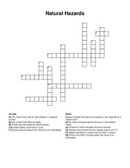
shaking of earth's crust caused by releasing of energy, point deep in earth at which the first movement occurs during an earthquake, eruption of …
a set of measures taken by individuals, organizations and society to minimize the effects of an earthquake, the ability to respond and adapt to …
high elevations at all latitudes, incoming solar radiation is the energy input for the climate system, winds flow from areas of high pressure to areas …
southwest: one of the main alaska native groups in the region, southeast: this icy landform created much of the landscape in the region, interior: the …
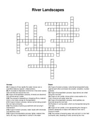
a type of erosion process; water reacts with chemicals and dissolves rocks, a type of river profile; a line representing the change in gradient …
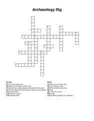
seeds the chumash used for food, an ancient hole punch, to dig, scientist who studies people and objects from the past, a rock used for paint, what …
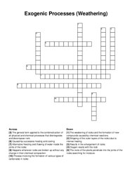
oxygen reacts with the rock, results in the enlargement of rocks, process involving the formation of various types of carbonates in rocks, the …
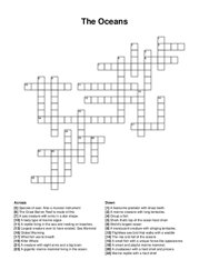
a marine creature with long tentacles, a creature with eight arms and a big brain, world's largest ocean, a translucent creature with stinging …
tides when sun and moon disable gravity pulls, large body of water on the west coast, tides when moon and sun distribute gravity pulls, when sea …
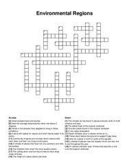
the uppermost layer of vegetation in terrestrial biome, a narrow stratum of rapid temperature change in the ocean and lakes, a terrestrial biome at …
the natural world of land, water, air, plants, and animals, material that is able to be readily decomposed or broken down by biological means, …
the ability of individuals to obtain food easily, growing crops in stacked layers to save space, deficiency or excess of nutrients affecting health, …
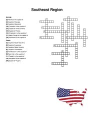
nashville is the capital of, capital of virginia, capital of louisiana, capital of florida, raleigh is the capital of, baton rouge is the capital of, …
this type of weathering is also referred to as mechanical weathering. it is the process of breaking up rock by physical forces, such as the action of …